30/09/2024 – Weather in Cornwall – Yellow Weather Warning For Rain
Warning for Heavy Rain in Effect from 16:00 Sunday 29 September until 09:00 Monday 30 September
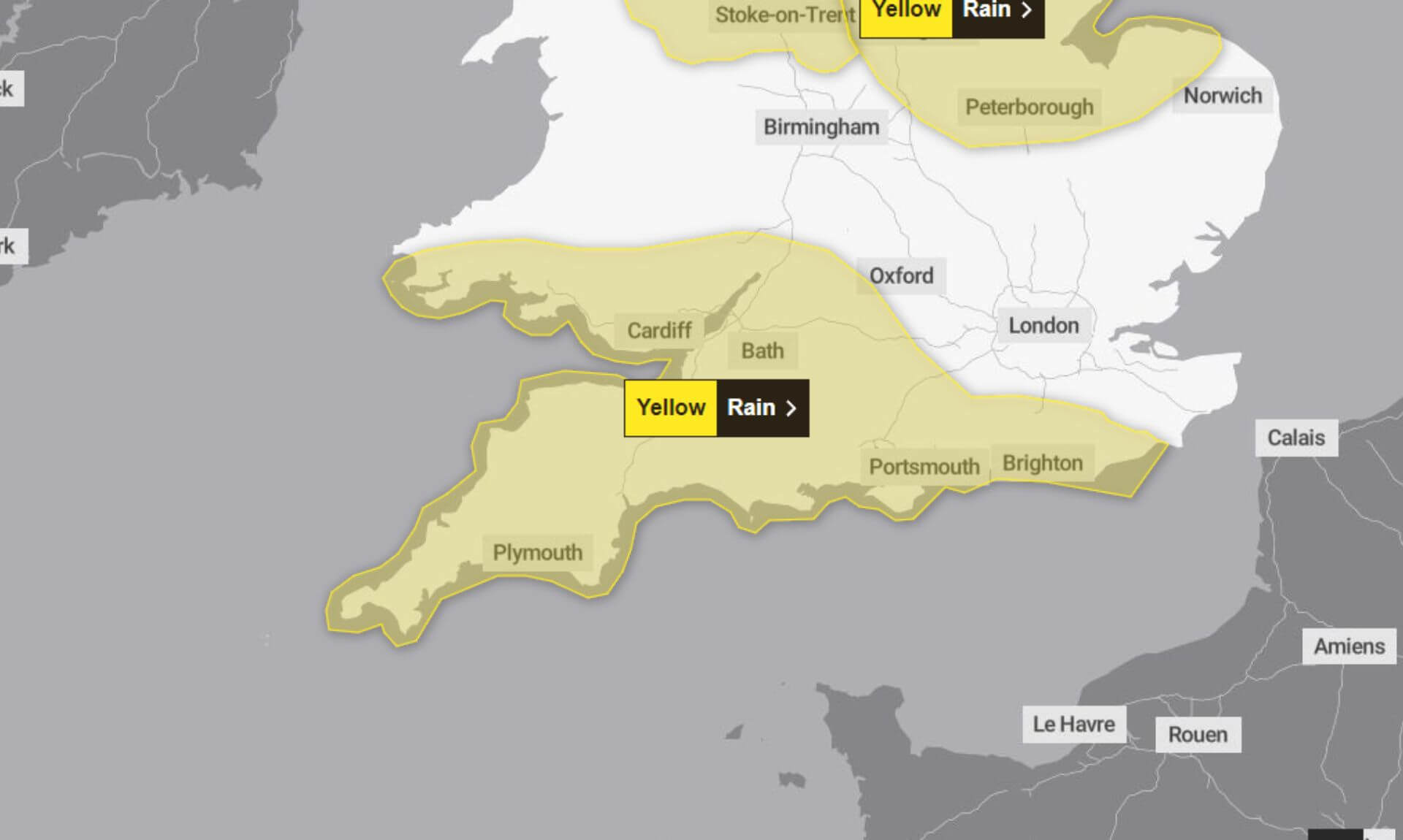
Residents across South West England and South Wales are being urged to prepare for further heavy rain, which is likely to disrupt travel and cause localised flooding. The Met Office has issued a yellow weather warning, indicating a medium likelihood of impact but with a lower overall severity. The rain began to develop on Sunday morning and is expected to ease gradually from the west overnight.
What to Expect
The Met Office has highlighted several potential issues that could arise due to the heavy rainfall:
- Travel Delays: Roads may be affected by spray and flooding, leading to longer journey times. Those using buses and trains are also likely to experience delays.
- Power Disruptions: Some interruptions to power supplies and other essential services are possible.
- Flooding: Homes and businesses in low-lying areas may experience flooding, particularly across South Wales, Dartmoor, and the Dorset Downs, where rainfall totals could reach 50-80 mm in some places.
How to Stay Safe
The Met Office recommends taking several precautions to stay safe during the heavy rain and possible flooding:
- Prepare for Flooding: Check if your property is at risk of flooding and consider creating a flood plan or emergency kit.
- Plan Your Journey: Stay informed about road conditions and transport disruptions. If necessary, alter your travel plans to avoid high-risk areas.
- Prepare for Power Cuts: Having a mobile phone power pack, torches, and spare batteries on hand could make power outages easier to manage.
Further Details
Rain is forecast to continue affecting much of South West England and South Wales throughout the evening and night. Over a 9-12 hour period, most areas can expect 20-30 mm of rain. However, higher ground in South Wales, Dartmoor, and the Dorset Downs could see accumulations of up to 80 mm.
South West England weather forecast
Headline:
Windy today with scattered showers, drier tomorrow with sunny spells.
Today:
A cloudy and blustery start with hill fog and occasional drizzly showers. Brief sunny intervals developing although further scattered showers remain possible. Staying windy with coastal gales possible at first. Maximum temperature 15 °C.
Tonight:
Clear intervals this evening with longer clear spells overnight, especially in the west. Scattered showers this evening but most of these fading away overnight. Blustery winds slowly easing. Minimum temperature 9 °C.
Tuesday:
A mainly dry day with a mixture of cloudy periods and sunny spells during the morning, then lengthier sunny periods developing later. Feeling warmer than on Monday with lighter winds. Maximum temperature 17 °C.
Outlook for Wednesday to Friday:
A generally dry end to the week with sunny/clear periods interspersed with occasional cloudier spells. Often chilly by night with patchy fog but daytime temperatures near average. Relatively light winds.
Updated:
Share This Story, Choose Your Platform!
To keep up with the latest cornish news follow us below
Follow CornishStuff on Facebook - Like our Facebook page to get the latest news in your feed and join in the discussions in the comments. Click here to give us a like!
Follow us on Twitter - For the latest breaking news in Cornwall and the latest stories, click here to follow CornishStuff on X.
Follow us on Instagram - We also put the latest news in our Instagram Stories. Click here to follow CornishStuff on Instagram.
You Might Also Be Interested In


Latest News In Cornwall


Daily Cornish news by email
The latest daily news in Cornwall, sent direct to your inbox.


