28/03/2024 – Weather in Cornwall – Yellow Wind Warning Issued for Cornwall
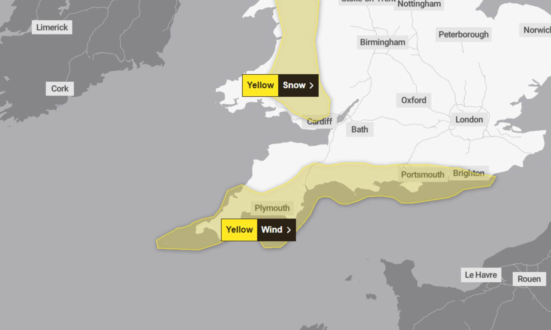
Thursday 28/03/2024 – The Met Office has issued a yellow warning for wind in Cornwall, effective from 07:00 to 18:00 today. Residents and visitors are being advised to brace for a day of strong winds coupled with large coastal waves, which are expected to create hazardous conditions across the region.
Travel Disruptions Expected
Travellers in Cornwall are warned of potential disruptions as the strong winds may impact road, rail, air, and ferry services. There is a small chance of longer journey times or cancellations, urging everyone to plan their journeys in advance and check for the latest updates from transport providers.
Utility and Communication Services at Risk
The adverse weather conditions also raise the slight possibility of power cuts, which could, in turn, affect other services including mobile phone coverage. Residents are advised to charge essential devices and make preparations for any potential outages.
Coastal Areas on High Alert
The combination of strong winds and large waves poses a significant risk along the coastline. There is a small chance that injuries and danger to life could occur, with beach material and debris potentially being thrown onto sea fronts, coastal roads, and properties. Authorities are urging the public to avoid dangerous areas and heed any warnings issued.
Road and Bridge Safety
Due to the expected conditions, there is a possibility that some roads and bridges in the region could close for safety reasons. Motorists are advised to follow local travel updates and exercise caution when travelling.
Public Advised to Stay Informed
Residents and visitors in Cornwall are encouraged to stay informed about the latest weather updates and heed any advice or instructions issued by local authorities. Preparing for the expected conditions and taking necessary precautions can help mitigate the impact of the strong winds and ensure safety for all.
South West England weather forecast
Headline:
Showers or longer spells of rain. Windy with coastal gales.
Today:
Further showers or more prolonged periods of rain during the morning, these heavy in places. Sunny spells and frequent heavy showers during the afternoon, thundery with hail in places. Windy, especially through the afternoon with coastal gales, and feeling cool. Maximum temperature 11 °C.
Tonight:
Showers soon fading, with clear spells for a time overnight before further showers pushing in along the south coast through the early hours. Chilly under the clearest skies. Winds easing. Minimum temperature 4 °C.
Friday:
A mixture of sunny spells and blustery scattered showers for Good Friday. These turning heavy and thundery at times. Feeling warm in any prolonged sunshine. Maximum temperature 13 °C.
Outlook for Saturday to Monday:
Staying changeable through the Easter weekend, with scattered showers and sunny spells on Saturday. Turning drier on Easter Sunday with lighter winds. Uncertainty on Monday with rain or showers possible.
Updated:
Share This Story, Choose Your Platform!
To keep up with the latest cornish news follow us below
Follow CornishStuff on Facebook - Like our Facebook page to get the latest news in your feed and join in the discussions in the comments. Click here to give us a like!
Follow us on Twitter - For the latest breaking news in Cornwall and the latest stories, click here to follow CornishStuff on X.
Follow us on Instagram - We also put the latest news in our Instagram Stories. Click here to follow CornishStuff on Instagram.
You Might Also Be Interested In


Latest News In Cornwall


Daily Cornish news by email
The latest daily news in Cornwall, sent direct to your inbox.


