27/09/2024 – Weather in Cornwall – Yellow Weather Warning For Rain
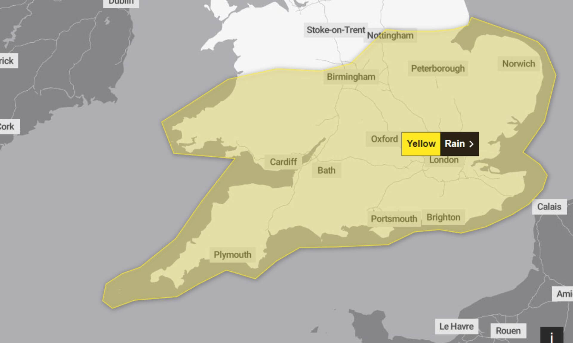
The Met Office has issued a yellow weather warning for rain, effective from 6 am today until 9 am today. The warning highlights the potential for flooding and transport disruptions as heavy rain and thunderstorms are expected to hit parts of Wales and central and eastern England.
What to Expect
The Met Office warns that some areas could experience significant rainfall, with the potential for 10-15 mm of rain within an hour. A few locations may see up to 30 mm of rainfall over several hours during the day. This could increase to 20-30 mm in 2-3 hours and potentially 40-60 mm in 3-6 hours during Thursday evening and early Friday morning. Given the recent wet weather, this could lead to further flooding and disruptions.
There is a small chance that homes and businesses could be flooded, causing damage to buildings. Flooding could also result in delays or cancellations to train and bus services, and difficult driving conditions with the possibility of road closures. Some communities might become temporarily cut off due to flooded roads.
The Met Office has also noted a slight chance of power cuts and the loss of other essential services to some homes and businesses. In extreme cases, fast-flowing or deep floodwater could pose a danger to life.
How to Stay Safe
Check if your property is at risk: If your home or business is in a flood-prone area, consider preparing a flood plan and an emergency flood kit.
Plan your travel: Check road conditions, bus, and train timetables before setting out. Be prepared to change your travel plans if necessary to avoid affected areas.
Prepare for power cuts: Ensure you have torches, batteries, a mobile phone power pack, and other essential items ready. It’s always best to be prepared in advance.
Stay updated: Weather warnings can change quickly. The Met Office recommends staying up to date with the latest weather forecast.
Why a Yellow Warning?
The yellow warning signifies a very low likelihood of medium impact. While not all areas will experience the worst of the weather, the conditions are unpredictable. The Met Office updated the warning this morning to reflect the earlier start time due to the expectation of heavy showers and thunderstorms throughout the day.
South West England weather forecast
Headline:
Heavy showers today, then heavy rain overnight. Colder tomorrow.
Today:
Sunny spells and showers for many, the showers turning heavy and blustery in places, with a risk of thunderstorms developing too. Feeling cool in the breeze, particularly around coasts and through the Bristol Channel. Maximum temperature 17 °C.
Tonight:
A showery evening, though some drier spells, perhaps with the odd clear interval. A band of more persistent rain feeding across the region from the north overnight. Coastal gales possible. Minimum temperature 8 °C.
Friday:
Early rain soon clearing. Sunny spells emerging afterwards, though the ongoing chance of showers, particularly in the west. Brisk northerly winds bringing a cold feel, despite the sunshine. Maximum temperature 15 °C.
Outlook for Saturday to Monday:
Fine on Saturday with some sunshine and light winds. Turning wet and windy during Sunday, then a little brighter, though with blustery showers on Monday. Chilly at first, milder later.
Updated:
South West England weather forecast
Headline:
Feeling cold but with sunny spells.
Today:
Early rain soon clearing. Sunny spells emerging afterwards, though the ongoing chance of showers, particularly in the west. Brisk northerly winds bringing a cold feel, despite the sunshine. Maximum temperature 15 °C.
Tonight:
Showers continuing in the west to end Friday but tending to ease overnight. Otherwise, dry with mostly clear skies as winds fall light. Chilly, with patchy frost in rural spots. Minimum temperature 3 °C.
Saturday:
Fine day with sunny spells and variable cloud spilling in during the day. Mostly dry with the outside chance of a light shower. Temperatures remaining below the seasonal average. Maximum temperature 15 °C.
Outlook for Sunday to Tuesday:
Increasingly wet and windy on Sunday. Mostly cloudy on Monday with further rain possible in the south. Drier on Tuesday with sunny spells. Briefly milder but colder again by Tuesday.
Updated:
Share This Story, Choose Your Platform!
To keep up with the latest cornish news follow us below
Follow CornishStuff on Facebook - Like our Facebook page to get the latest news in your feed and join in the discussions in the comments. Click here to give us a like!
Follow us on Twitter - For the latest breaking news in Cornwall and the latest stories, click here to follow CornishStuff on X.
Follow us on Instagram - We also put the latest news in our Instagram Stories. Click here to follow CornishStuff on Instagram.
You Might Also Be Interested In


Latest News In Cornwall


Daily Cornish news by email
The latest daily news in Cornwall, sent direct to your inbox.


