27/01/2025 – Weather in Cornwall – Yellow Weather Warning For Wind and Rain
Prepare for Disruption as Flooding and Strong Winds Hit the Region
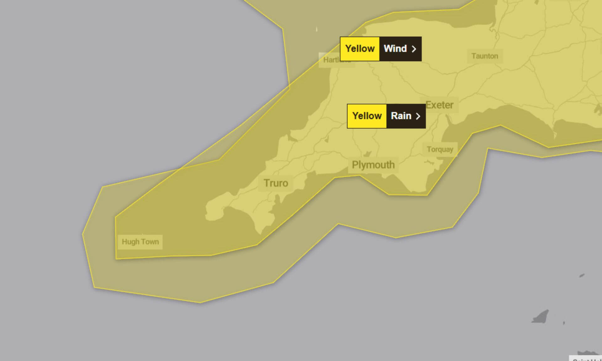
The Met Office has issued dual yellow weather warnings for rain and wind, spanning from 7:58am today (Monday) to 10:00am tomorrow (Tuesday), with strong gusts persisting until 6:00am Tuesday. Residents and travellers across Cornwall are being urged to prepare for challenging conditions, including flooding, dangerous roads, and potential power cuts.
What to Expect
Heavy Rain and Thunderstorms
The rain warning highlights heavy, blustery showers with potential thunderstorms and hail. Flooding of roads, homes, and businesses is possible, with additional hazards from spray and dangerous driving conditions. Lightning strikes and hail may further disrupt road travel.
Strong and Gusty Winds
The wind warning predicts gusts of up to 60–70mph near the coast and up to 50mph inland. Coastal areas could see large waves and spray impacting sea fronts and routes. Delays on roads, rail, air, and ferry transport are likely, and high-sided vehicles on exposed routes could face significant challenges.
Possible Impacts
- Flooding of roads, homes, and businesses
- Longer journey times on roads and public transport
- Short-term power cuts and interruptions to services
- Dangerous coastal conditions, including large waves and potential cliff hazards
How to Stay Safe
Plan Ahead
Before travelling, check road conditions, bus and train timetables, and consider adjusting plans to avoid delays. For coastal routes, exercise caution near large waves and cliffs.
Prepare for Power Cuts
Gather essentials like torches, batteries, and a mobile phone power pack. These simple preparations can make coping with outages easier.
Flood Preparedness
If your property is at risk of flooding, the Met Office advises creating a flood plan and assembling an emergency flood kit.
Stay Updated
Weather conditions can change rapidly. The Met Office recommends monitoring the latest forecasts and being ready for updates to warnings.
Why Yellow Warnings?
Both warnings are classified as having a medium likelihood and low impact. Despite this, the combination of heavy rain and strong winds could create significant disruption, particularly in coastal and flood-prone areas.
South West England weather forecast
Headline:
Very windy today with frequent heavy and possibly thundery showers.
Today:
Frequent blustery showers with heavy and thundery downpours and hail possible in places, interspersed with sunnier intervals. Windy for all and very windy in coastal areas with severe gales possible. Maximum temperature 9 °C.
Tonight:
Further heavy showers this evening and overnight. Staying windy with gales in coastal and upland areas. A relatively mild and frost free night. Minimum temperature 6 °C.
Tuesday:
A mostly cloudy and showery day, though the showers not quite as heavy or as frequent as on Monday with perhaps a few brighter intervals. Windy with gales in places. Maximum temperature 9 °C.
Outlook for Wednesday to Friday:
The chance of further heavy rain and coastal gales in southern counties on Wednesday. Mostly dry on Thursday with some sunshine, then cloudier on Friday. Temperatures near average.
Updated:
Share This Story, Choose Your Platform!
To keep up with the latest cornish news follow us below
Follow CornishStuff on Facebook - Like our Facebook page to get the latest news in your feed and join in the discussions in the comments. Click here to give us a like!
Follow us on Twitter - For the latest breaking news in Cornwall and the latest stories, click here to follow CornishStuff on X.
Follow us on Instagram - We also put the latest news in our Instagram Stories. Click here to follow CornishStuff on Instagram.
You Might Also Be Interested In


Latest News In Cornwall


Daily Cornish news by email
The latest daily news in Cornwall, sent direct to your inbox.


