25/01/2025 – Weather in Cornwall – Yellow Weather Warning For Ice
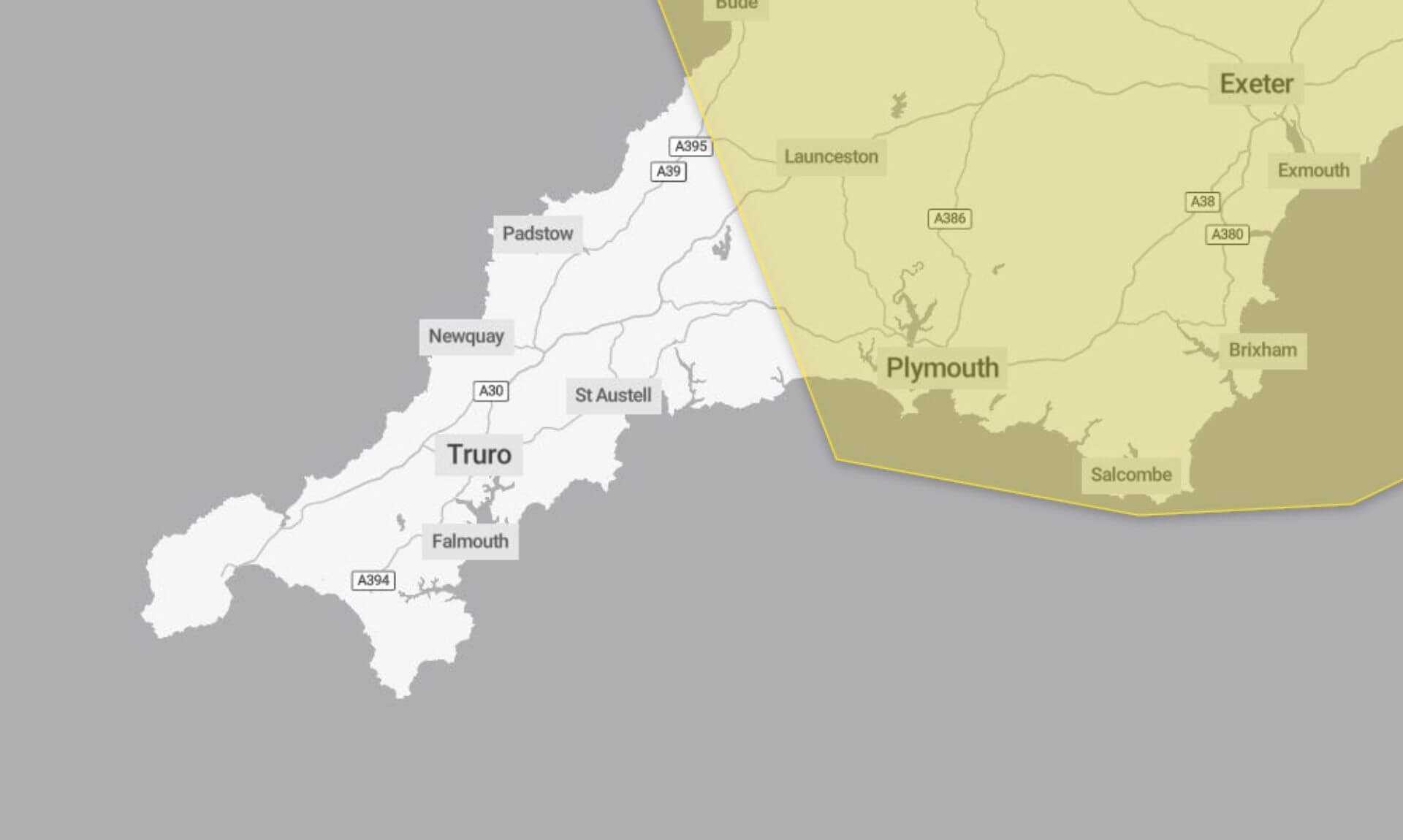
The Met Office has issued a yellow weather warning for ice, in effect from 3:00 am to 10:00 am today, warning of hazardous conditions on Saturday morning. The cold spell is expected to create potentially dangerous icy stretches on untreated roads, pavements, and cycle paths.
What to Expect
The warning highlights the likelihood of icy patches forming, particularly on untreated surfaces. This could result in some injuries from slips and falls, as well as potential disruption to travel plans. Those venturing out are advised to remain cautious, as travelling conditions could become hazardous.
The Cause
Showers that moved across the region on Friday evening and early Saturday morning have left surfaces damp. With skies clearing after these showers, ice is expected to form, particularly on untreated areas, increasing the risk of accidents.
How to Stay Safe
The Met Office advises a range of precautions to minimise risks:
- Plan Ahead: Leave at least five minutes earlier than usual to avoid rushing, reducing your risk of slips and falls.
- Choose Safer Routes: Stick to pavements along main roads and treated cycle paths wherever possible. These areas are more likely to be free of ice.
- Driving or Public Transport: Check road conditions, bus, and train schedules before setting off. Be prepared to adjust travel plans if necessary.
- Stay Updated: Weather warnings can change, so it’s essential to stay informed about the latest forecast for your area.
Why the Warning is Yellow
The yellow warning reflects a medium likelihood of ice with a low impact, according to the Met Office.
Stay cautious, and plan accordingly to ensure your safety during the icy spell.
South West England weather forecast
Headline:
Dry with lengthy sunny spells. Freshening winds later.
Today:
A mainly dry day with lengthy sunny periods, but the odd shower is possible around western coasts with a band of heavier showers arriving later in the day. Freshening winds during the afternoon. Maximum temperature 6 °C.
Tonight:
Cloud increasing from the west with a band of showers moving quickly eastwards overnight, before fading out. Clear spells follow with temperatures dropping close to freezing in places. Minimum temperature -1 °C.
Sunday:
Outbreaks of rain, locally heavy already across parts of Devon and Cornwall will spread across the whole region during the morning. Winds strengthening with gales or severe gales developing. Maximum temperature 7 °C.
Outlook for Monday to Wednesday:
Remaining unsettled both Monday and Tuesday with showers or longer spells of rain around, windy. Similar on Wednesday with strengthening winds and heavy rain arriving later. Near normal temperatures.
Updated:
Share This Story, Choose Your Platform!
To keep up with the latest cornish news follow us below
Follow CornishStuff on Facebook - Like our Facebook page to get the latest news in your feed and join in the discussions in the comments. Click here to give us a like!
Follow us on Twitter - For the latest breaking news in Cornwall and the latest stories, click here to follow CornishStuff on X.
Follow us on Instagram - We also put the latest news in our Instagram Stories. Click here to follow CornishStuff on Instagram.
You Might Also Be Interested In


Latest News In Cornwall


Daily Cornish news by email
The latest daily news in Cornwall, sent direct to your inbox.


