23/01/2025 – Weather in Cornwall – Yellow Weather Warning For Wind
Brace for Strong Winds: Met Office Issues Yellow Weather Warning for Today
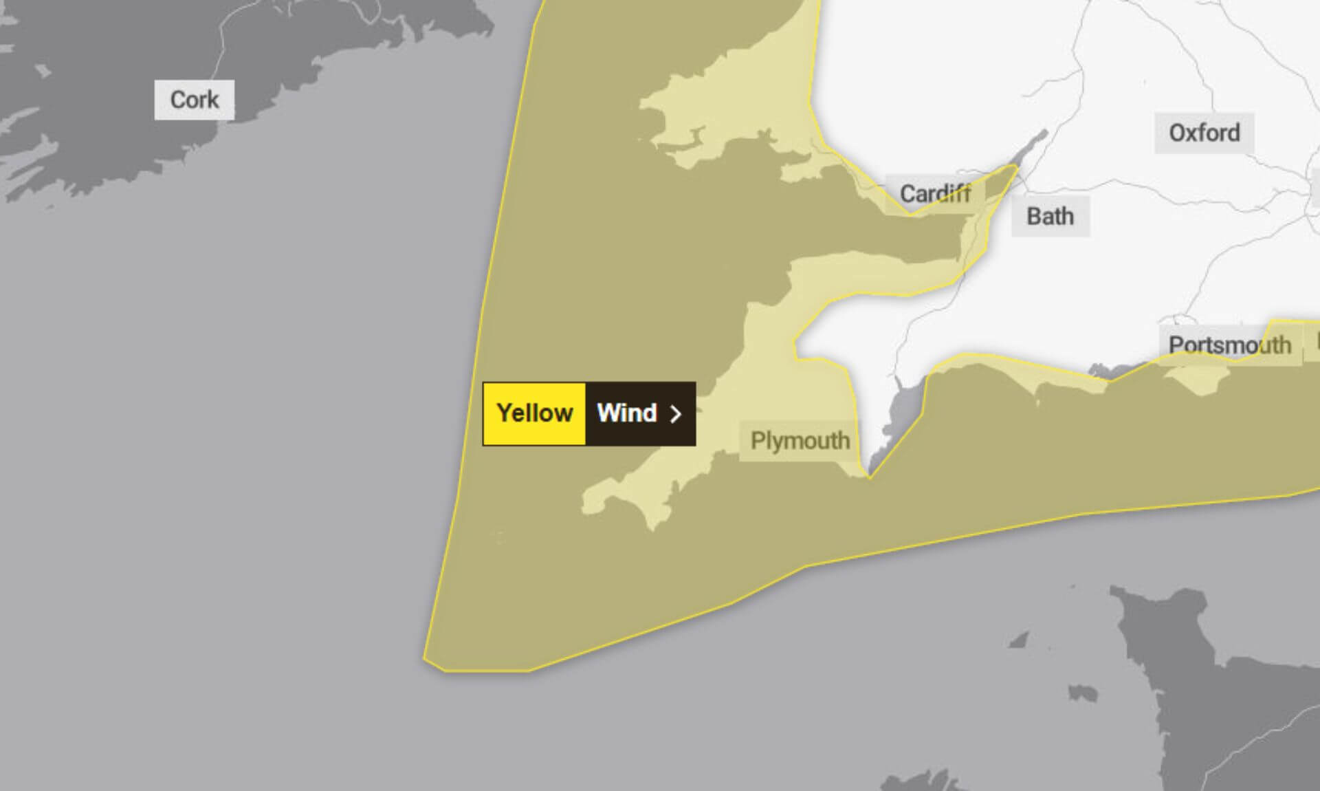
The Met Office has issued a Yellow Weather Warning for Wind covering today, Thursday, from 7:00 am to 6:00 pm. A band of strong and gusty winds is forecast to sweep west to east across the affected area, accompanied by a short spell of heavy rain.
What to Expect
The warning highlights the likelihood of disruptions in certain areas:
- Coastal impacts: Spray and large waves are expected to affect coastal routes, sea fronts, and communities.
- Travel delays: Bus and train services may face delays, potentially extending journey times.
- Power interruptions: Some short-term loss of power and other services is possible.
- Vehicle delays: High-sided vehicles on exposed routes and bridges are likely to experience delays.
Further Details
The strongest winds, reaching speeds of 50–60 mph over exposed coasts and hills, are expected to coincide with a four-to-five-hour period of heavy rain.
- Western areas: Winds will peak in the morning before easing in the afternoon.
- Eastern areas: Gusts will strengthen during the afternoon, tapering off later in the day.
Advice for Staying Safe
The Met Office offers practical advice for those affected by today’s weather:
- Travel plans: Check road conditions and public transport timetables before setting out. Adjust travel plans if necessary to avoid delays.
- Coastal safety: If visiting the coast, be cautious around large waves. Breaking waves can sweep people off their feet, even from the shore. Take extra care near cliffs by planning your route and keeping dogs on leads.
- Emergencies: If caught in a dangerous situation, call 999 and ask for the Coastguard.
- Stay informed: Keep an eye on weather updates throughout the day, as warnings may change quickly.
Why a Yellow Warning?
The Met Office describes this warning as having a medium likelihood but low impact, reflecting potential disruption that should not be overlooked.
South West England weather forecast
Headline:
Very windy with heavy spells of rain moving eastwards.
Today:
A wet and windy day with strong and gusty winds bringing possible disruption in the southwest. A band of rain spreads steadily eastwards, heavy at times, though with brighter skies to follow. Remaining breezy into the afternoon. Maximum temperature 10 °C.
Tonight:
A briefly dry and settled evening, however cloud soon thickens from the southwest overnight, with strengthening winds and heavy rain spreading into the southwest marking the arrival of Storm Éowyn. Minimum temperature 7 °C.
Friday:
Wet and very windy as Storm Éowyn clears eastwards, with some heavy downpours at first. Brighter skies to follow with winds gradually subsiding, and even some afternoon sunshine. Maximum temperature 10 °C.
Outlook for Saturday to Monday:
Lighter winds on Saturday with some sunshine, before turning wet and windy from Sunday with heavy rain arriving from the southwest. Unsettled with coastal gales and blustery showers on Monday.
Updated:
Share This Story, Choose Your Platform!
To keep up with the latest cornish news follow us below
Follow CornishStuff on Facebook - Like our Facebook page to get the latest news in your feed and join in the discussions in the comments. Click here to give us a like!
Follow us on Twitter - For the latest breaking news in Cornwall and the latest stories, click here to follow CornishStuff on X.
Follow us on Instagram - We also put the latest news in our Instagram Stories. Click here to follow CornishStuff on Instagram.
You Might Also Be Interested In


Latest News In Cornwall


Daily Cornish news by email
The latest daily news in Cornwall, sent direct to your inbox.


