22/11/2024 – Weather in Cornwall – Yellow Weather Warning For Ice
Warning in Effect from Thursday Evening to Friday Morning
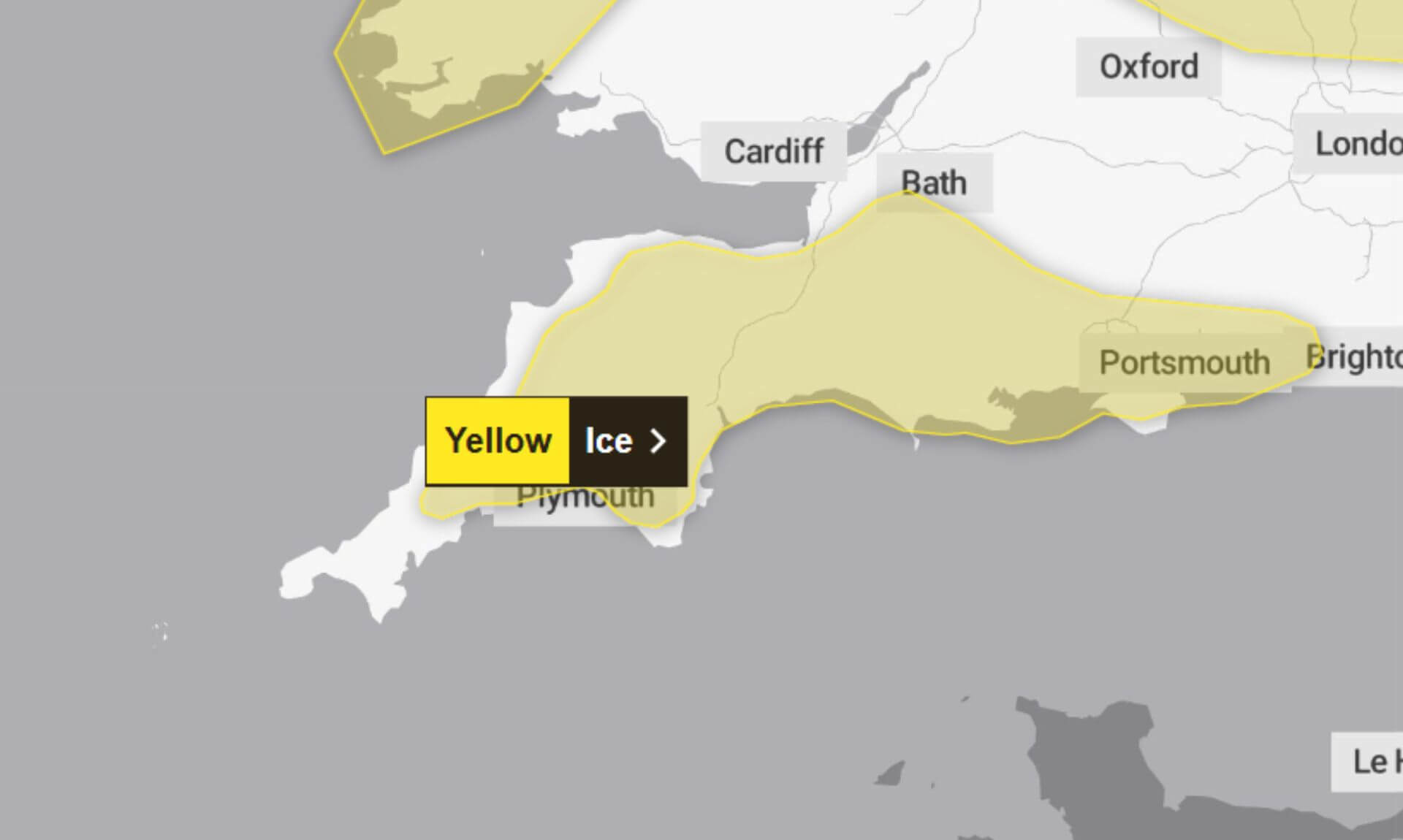
The Met Office issued a yellow weather warning for ice, covering the period from 5pm on Thursday, 21st November, until 10am today. The warning highlights potential hazards caused by icy stretches on untreated roads, pavements, and cycle paths.
Travellers are advised to exercise caution, with the Met Office warning of possible injuries from slips and falls on icy surfaces.
What to Expect on Icy Roads and Pavements
As temperatures dipped below freezing overnight, icy patches are expected to have formed on untreated surfaces. The far west of the warning area might have seen occasional wintry showers, with snowfall of 1 to 2 cm possible above 200 metres.Pavements along main roads are likely to be less slippery, and drivers are encouraged to check road conditions before setting out. Public transport users are advised to verify bus and train schedules in case of delays or disruptions.
Tips to Stay SafeThe Met Office has recommended several steps to reduce risks and manage travel during icy conditions:
- Leave earlier: Allow an extra five minutes to avoid the need to rush, reducing the likelihood of accidents, slips, or falls.
- Stick to main roads: Both pedestrians and cyclists should favour main routes, which are more likely to have been treated for ice.
- Check conditions: Monitor road conditions and travel updates before heading out, and amend plans as needed.
The Met Office reminds the public that weather warnings can change and encourages everyone to stay up to date with the latest forecast.
Why A Yellow Weather Warning?
The yellow warning indicates a medium likelihood of icy conditions, with a low overall impact expected. While the conditions may be manageable, taking precautions is essential to avoid unnecessary risks.
South West England weather forecast
Headline:
Storm Bert to bring possible disruption this weekend.
Today:
Wintry showers bring the risk of icy stretches during the morning, mainly across western counties, before gradually fading during the day. Sunny spells for many in the afternoon. A cold day, though winds easing later. Maximum temperature 8 °C.
Tonight:
A dry but chilly evening. Cloud building as Storm Bert arrives overnight, with rain becoming widespread, heavy and persistent. Winds strengthening again with gales along coasts and over hills. Minimum temperature 0 °C.
Saturday:
Storm Bert bringing a widely unsettled and potentially disruptive day with heavy, persistent rain and gales, severe along coasts. Turning noticeably milder, resulting in a rapid melt of lying snow. Maximum temperature 13 °C.
Outlook for Sunday to Tuesday:
Rain clearing through Sunday with showers and brighter spells on Monday and Tuesday. Strongest winds easing but staying blustery. Mild on Sunday then temperatures returning to the seasonal average.
Updated:
Share This Story, Choose Your Platform!
To keep up with the latest cornish news follow us below
Follow CornishStuff on Facebook - Like our Facebook page to get the latest news in your feed and join in the discussions in the comments. Click here to give us a like!
Follow us on Twitter - For the latest breaking news in Cornwall and the latest stories, click here to follow CornishStuff on X.
Follow us on Instagram - We also put the latest news in our Instagram Stories. Click here to follow CornishStuff on Instagram.
You Might Also Be Interested In


Latest News In Cornwall


Daily Cornish news by email
The latest daily news in Cornwall, sent direct to your inbox.


