18/01/2024 – Yellow Warning Still In Place for Ice and Snow in Cornwall
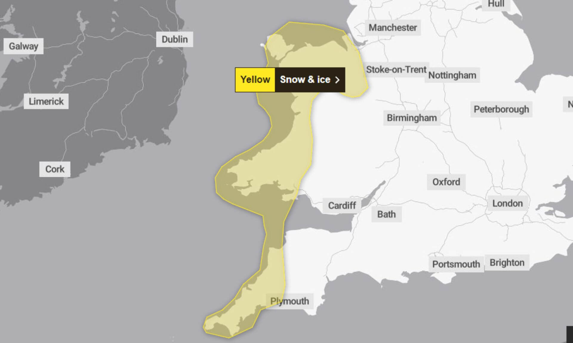
As we continue to feel the winter’s cold grip, the MET Office has kept its yellow weather alert for today, Thursday, 18th January 2024. This warning highlights the likelihood of treacherous ice and snow showers that may impact travel during this morning in several areas. Travelers are encouraged to prepare for challenging conditions.
What to Expect:
- Transport Disruptions: The wintry weather is likely to impact both roads and railways, resulting in longer journey times. Motorists, bus passengers, and train commuters should anticipate delays and plan their journeys accordingly.
- Icy Roads and Paths: Untreated roads, pavements, and cycle paths are at a high risk of developing icy patches, making travel treacherous. Local authorities are expected to deploy gritters, but caution is advised for early-morning travellers.
- Risk of Slips and Falls: The icy conditions increase the risk of slips and falls on outdoor surfaces. The public is advised to wear appropriate footwear and be cautious while walking on icy paths.
The MET Office urges the public to stay informed about the latest weather updates and travel advisories. Elderly and vulnerable individuals are advised to avoid unnecessary travel and seek assistance if needed. Schools and businesses in the affected areas are preparing for potential impacts, with some considering delayed openings to ensure safety.
Local emergency services are on alert, and the public is encouraged to report any hazardous conditions to the authorities. The yellow weather alert underscores the need for vigilance and preparedness as the nation navigates another winter challenge.
South West England weather forecast
Headline:
Feeling cold with blue skies and some flurries of snow.
Today:
Another dry, sunny and cold day for most after a very frosty and locally icy start. Scattered wintry showers are likely to affect Cornwall and west Devon at times, brining a little snow over the moors. Maximum temperature 4 °C.
Tonight:
Any snow showers fading into the evening leaving a largely dry and clear night with temperatures quickly plummeting after sunset. Another widespread and severe frost developing with icy patches. Minimum temperature -4 °C.
Friday:
Another very cold start with a widespread, sharp frost and icy stretches. Staying cold with plenty of sunshine and blue skies to end the week. Maximum temperature 6 °C.
Outlook for Saturday to Monday:
A change is on the way over the weekend and into next week as the weather turns milder, wetter and much windier with coastal gales possible and some rain too.
Updated:
Share This Story, Choose Your Platform!
To keep up with the latest cornish news follow us below
Follow CornishStuff on Facebook - Like our Facebook page to get the latest news in your feed and join in the discussions in the comments. Click here to give us a like!
Follow us on Twitter - For the latest breaking news in Cornwall and the latest stories, click here to follow CornishStuff on X.
Follow us on Instagram - We also put the latest news in our Instagram Stories. Click here to follow CornishStuff on Instagram.
You Might Also Be Interested In


Latest News In Cornwall


Daily Cornish news by email
The latest daily news in Cornwall, sent direct to your inbox.


