15/04/2025 – Weather in Cornwall – Yellow Weather Warning For Rain
Heavy Rain Warning Issued: Could Your Area Be at Risk of Flooding?
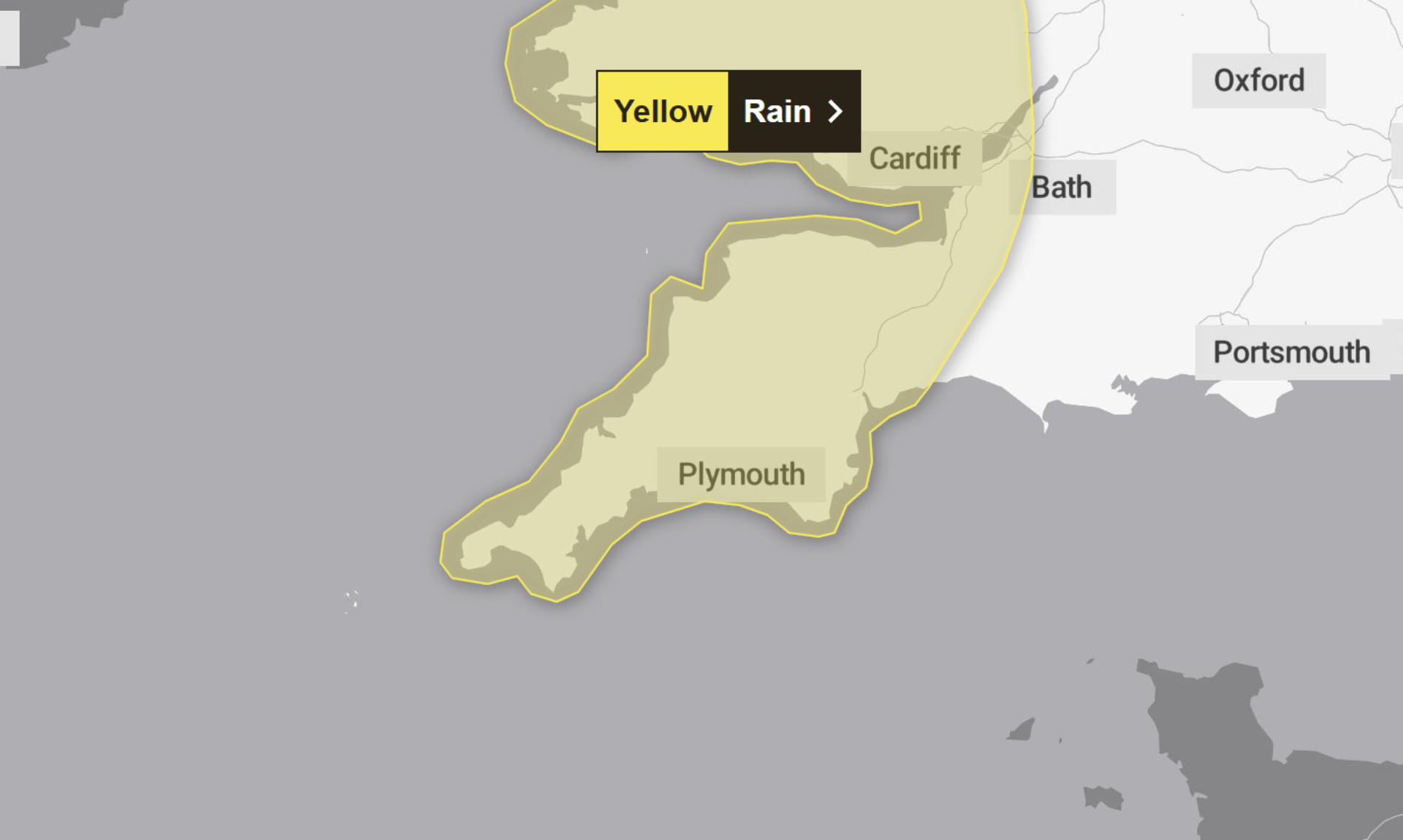
A yellow weather warning for rain has been issued across parts of western Britain, including Cornwall, from midday today (Tuesday 15th April) until midday tomorrow (Wednesday 16th April).
The Met Office has warned that heavy and persistent rainfall could lead to localised flooding, transport delays, and possible power interruptions as the unsettled weather moves north through Tuesday and into early Wednesday.
What to Expect
The warning includes the possibility of:
-
Flooding of a few homes and businesses
-
Spray and flooding on roads, likely causing longer journey times
-
Disruption to bus and train services
-
A chance of power cuts and interruptions to other services
According to the Met Office, 20–40mm of rain is expected fairly widely, with some locations potentially seeing 50–75mm. In the west, rainfall will build gradually following showers on Monday, while the east may experience heavy downpours and slow-moving thunderstorms in a shorter timeframe.
How to Prepare
Residents are urged to check if their properties are at risk of flooding, and consider creating a flood plan and assembling an emergency flood kit.
Drivers are advised to check road conditions and travel updates before setting off, as journey times may be longer. Those using public transport should keep an eye on bus and train timetables and adjust travel plans if needed.
To prepare for potential power outages, the Met Office recommends having torches, batteries, and a mobile phone power pack ready, along with other essentials.
Stay Updated
The Met Office stresses that weather warnings can change quickly and advises the public to keep up to date with the latest forecast for their area.
Why A Yellow Weather Warning?
This yellow warning signifies a medium likelihood of impacts and a low overall level of impact—but those in affected areas are still encouraged to be cautious and stay prepared.
South West England weather forecast
Headline:
Cloudy with rain, heavy and possibly thundery, edging eastwards today.
Today:
A cloudier and cooler day than on Monday with heavy rain in the west edging slowly eastwards, perhaps thundery in places during the afternoon. Windy in the west, with some strong winds developing on exposed coasts and hills. Maximum temperature 19 °C.
Tonight:
Further rain, heavy at times, continuing to move steadily north and east overnight. The rain gradually easing by dawn. Windy, especially along exposed coasts and hills. A mild night. Minimum temperature 4 °C.
Wednesday:
Cloud and rain clearing the north of the region during the morning. Becoming drier and brighter, with sunny spells into the afternoon. A few scattered showers likely. Breezy and cooler. Maximum temperature 15 °C.
Outlook for Thursday to Saturday:
Sunny spells and scattered showers Thursday. Cloud and outbreaks of rain probably spreading northwards during Friday. Drier and brighter on Saturday, before further rain arrives later. Temperatures near normal.
Updated:
Share This Story, Choose Your Platform!
To keep up with the latest cornish news follow us below
Follow CornishStuff on Facebook - Like our Facebook page to get the latest news in your feed and join in the discussions in the comments. Click here to give us a like!
Follow us on Twitter - For the latest breaking news in Cornwall and the latest stories, click here to follow CornishStuff on X.
Follow us on Instagram - We also put the latest news in our Instagram Stories. Click here to follow CornishStuff on Instagram.
You Might Also Be Interested In


Latest News In Cornwall


Daily Cornish news by email
The latest daily news in Cornwall, sent direct to your inbox.


