10/01/2025 – Weather in Cornwall – Yellow Weather Warning For Ice
Will You Face Icy Surfaces This Morning? Met Office Issues Yellow Weather Warning
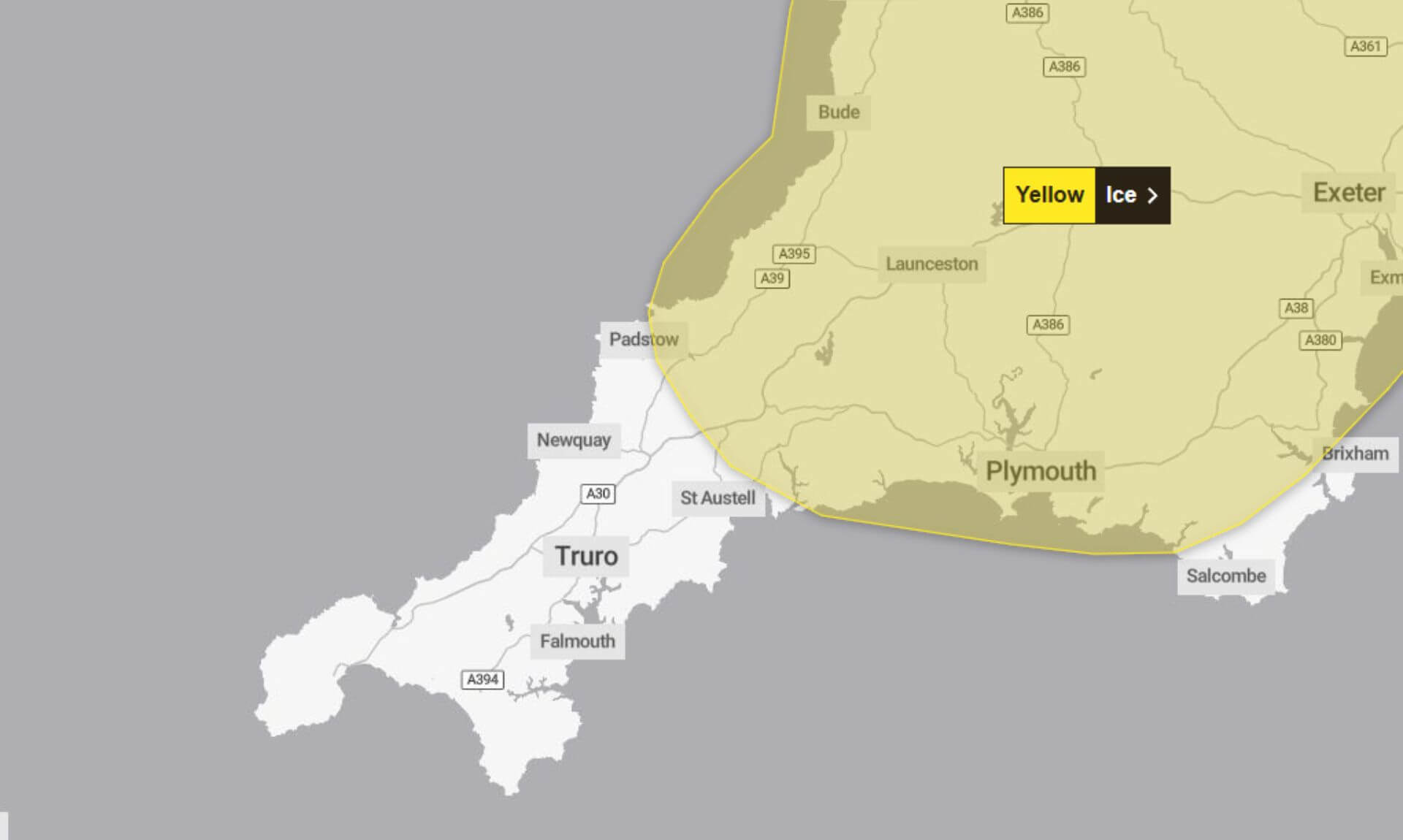
Early Morning Ice Alert
The Met Office has issued a Yellow Weather Warning for Ice from 3:00 am to 11:00 am today, urging caution as patchy rain, sleet, and hill snow could create hazardous conditions.
What to Expect
Drivers, cyclists, and pedestrians are being warned of potential icy patches, particularly on untreated roads, pavements, and cycle paths. The Met Office highlighted the following risks:
- Untreated surfaces: Some areas could become slippery due to ice formation.
- Risk of injury: There is a chance of slips and falls on icy surfaces.
Those travelling in higher areas above 150m may encounter light snowfall, with 1-2 cm of snow possible. In some places, such as Dartmoor, there is a slight chance of 3-5 cm of accumulation.
Areas of Uncertainty
While the south-west and hill regions are most at risk, the forecast notes some uncertainty for areas further north and east. Places like Wales may see much drier conditions with minimal precipitation.
Safety Advice
The Met Office has issued practical guidance to help minimise risks during icy conditions:
- Leave early: Add an extra five minutes to your journey to avoid rushing.
- Stick to treated paths: Main roads and pavements are more likely to have been gritted.
- Check travel updates: Keep an eye on bus and train timetables and adjust plans if needed.
For those planning to drive, it’s recommended to check local road conditions to avoid potential delays.
Why a Yellow Warning?
The Yellow Weather Warning indicates a medium likelihood of ice forming, though the impact is expected to remain low. The Met Office stresses the importance of staying updated as conditions could change throughout the morning.
South West England weather forecast
Headline:
Cold and frosty in the east, cloudier in the west.
Today:
A cold morning in the east with patchy freezing fog and icy stretches in places. Slightly milder in the west, with rain and hill snow becoming increasingly patchy, although a blanket of cloud spreads steadily eastwards through the day. Maximum temperature 6 °C.
Tonight:
Mainly cloudy with further outbreaks of rain and hill snow in the west overnight. Drier in the east, with icy stretches and freezing fog forming beneath any clear skies. Minimum temperature -1 °C.
Saturday:
Thick cloud in the west brings further patchy light rain and hill snow through the morning, but otherwise settled with the best of the sunshine in the east. Maximum temperature 7 °C.
Outlook for Sunday to Tuesday:
Dry and bright on Sunday, with occasional sunny spells. Turning milder next week, but cloudier and breezier too with southwesterly winds bringing patchy rain on Monday and Tuesday.
Updated:
Share This Story, Choose Your Platform!
To keep up with the latest cornish news follow us below
Follow CornishStuff on Facebook - Like our Facebook page to get the latest news in your feed and join in the discussions in the comments. Click here to give us a like!
Follow us on Twitter - For the latest breaking news in Cornwall and the latest stories, click here to follow CornishStuff on X.
Follow us on Instagram - We also put the latest news in our Instagram Stories. Click here to follow CornishStuff on Instagram.
You Might Also Be Interested In


Latest News In Cornwall


Daily Cornish news by email
The latest daily news in Cornwall, sent direct to your inbox.


