08/04/2024 – Weather in Cornwall – Yellow Weather Warning For This Evening
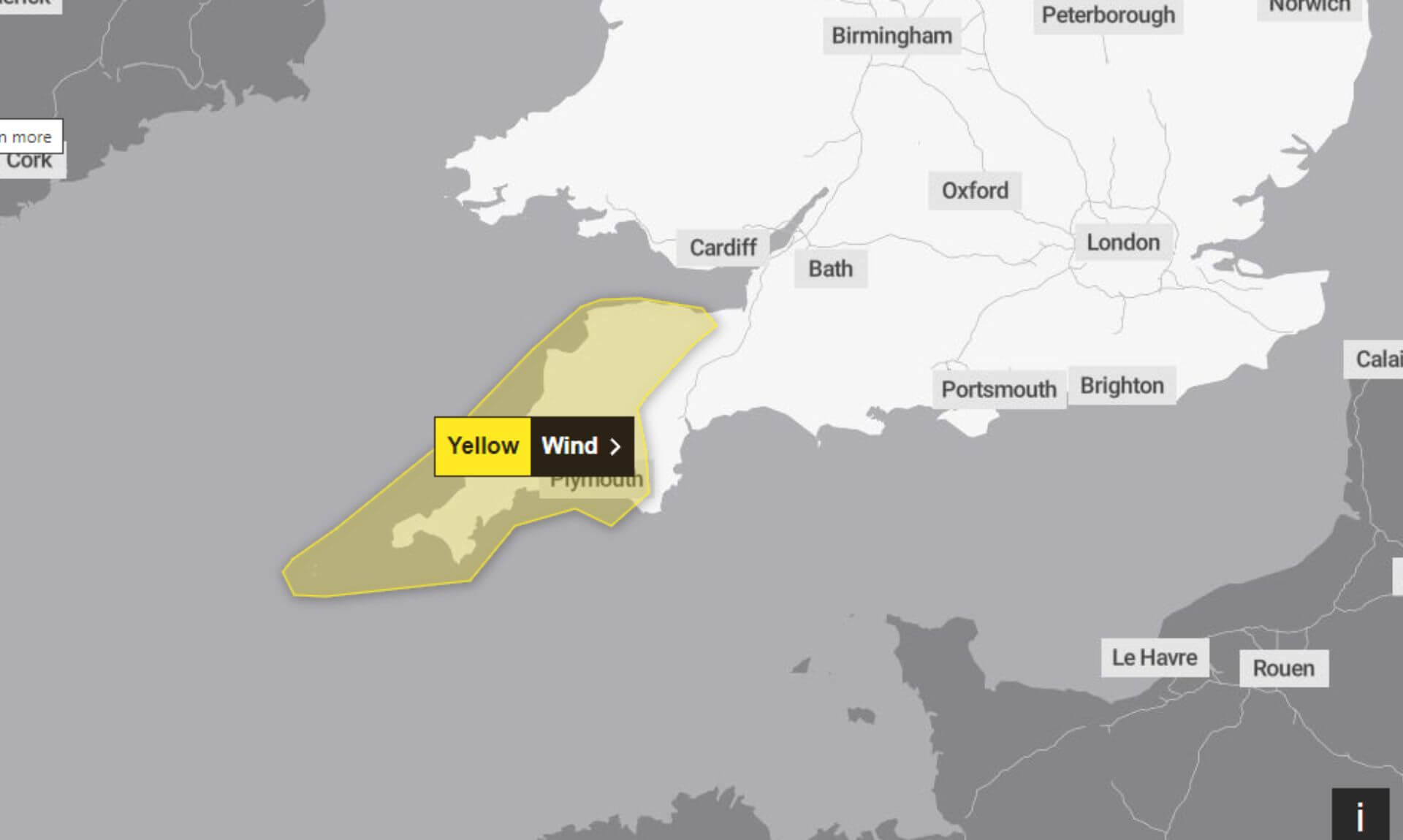
Monday 08/04/2024 – The Met Office has issued a yellow weather warning for wind, effective from 18:00 today until 06:00 tomorrow.
Residents and travellers are advised to prepare for strong winds and large coastal waves, which are expected to cause some disruption across affected areas.
Potential Hazards
Officials warn that there is a small chance of injuries or danger to life resulting from large waves and beach material being thrown onto seafronts, coastal roads, and properties. Flying debris from strong winds may also pose a significant risk elsewhere.
Impact on Services and Transport
The warning includes a caution that power cuts may occur, with the potential to impact other services, such as mobile phone coverage. This could affect communication and the ability to receive updates about the weather conditions and any further warnings.
Additionally, some delays to road, rail, air, and ferry transport are possible. Travellers are urged to check their travel plans and prepare for disruptions. Adjusting travel times or routes may be necessary to ensure safety.
Safety Advice
The Met Office advises the public to stay informed about the weather conditions and to follow any advice or instructions issued by local authorities. Securing loose items outdoors and avoiding coastal areas during the warning period are recommended to minimise the risk of injury or damage.
Stay Updated
For ongoing updates and more detailed information, residents and travellers are encouraged to monitor the Met Office’s official channels and local news outlets. Preparing for potential disruptions and adhering to safety advice is crucial during this period.
South West England weather forecast
Headline:
Often cloudy with spells of rain. Turning increasingly windy.
Today:
Cloudy with outbreaks of rain in the west, turning heavy at times and becoming more widespread by the afternoon, before sweeping northwards. Winds increasing with gales possible along exposed coasts during the evening. Maximum temperature 13 °C.
Tonight:
A windy end to the day with coastal gales possible along exposed coasts. Outbreaks of rain continuing throughout the night, becoming heavier and persistent; patchier for a time further east. Minimum temperature 5 °C.
Tuesday:
An unsettled start with strong winds and heavy rain, turning more showery through the afternoon with some brighter intervals developing. Feeling cooler with winds easing during the evening. Maximum temperature 11 °C.
Outlook for Wednesday to Friday:
Chillier and drier to start on Wednesday ahead of further rain arriving from the west. Rather cloudy on Thursday and Friday with rain or drizzle at times. Feeling warmer.
Updated:
Share This Story, Choose Your Platform!
To keep up with the latest cornish news follow us below
Follow CornishStuff on Facebook - Like our Facebook page to get the latest news in your feed and join in the discussions in the comments. Click here to give us a like!
Follow us on Twitter - For the latest breaking news in Cornwall and the latest stories, click here to follow CornishStuff on X.
Follow us on Instagram - We also put the latest news in our Instagram Stories. Click here to follow CornishStuff on Instagram.
You Might Also Be Interested In


Latest News In Cornwall


Daily Cornish news by email
The latest daily news in Cornwall, sent direct to your inbox.


