07/01/2025 – Weather in Cornwall – Yellow Weather Warning For Snow & Ice
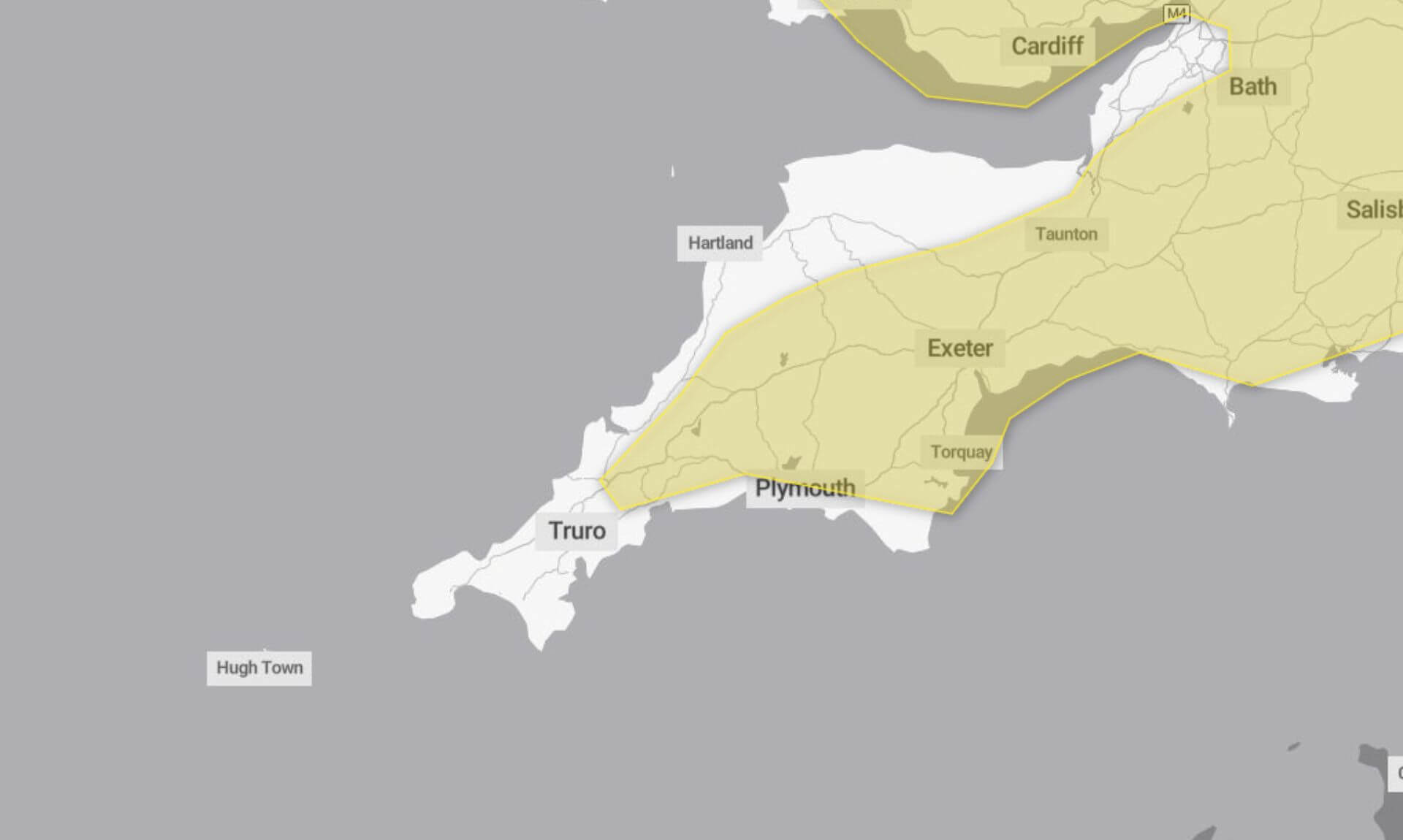
A yellow weather warning for snow and ice was issued by the Met Office, covering the period from 5pm on Monday 6th January to 10am this morning. The wintry conditions have brought icy stretches and sleet or snow showers, causing potential travel disruption.
What You Need to Know
The Met Office warned that roads and railways are likely to be affected, potentially leading to longer journey times for road users, bus passengers, and train services. Untreated roads, pavements, and cycle paths could see icy patches, increasing the risk of slips and falls.
In a statement, the Met Office said, “Frequent sleet or snow showers are also expected to affect Wales and parts of northwest and southwest England, moving into the Midlands and parts of southern England during the rest of the night.”
Snowfall Expected in Higher Areas
Areas above 200 metres could see snow accumulations of 2-4 cm, with some places above 300 metres, such as parts of North Wales, northwest England, and the Peak District, seeing as much as 5-10 cm of snow. In some cases, heavier and more persistent bands may bring snowfall to lower levels.
The icy conditions are partly due to wet surfaces from earlier rain and snowmelt, which have now frozen in the colder temperatures.
Advice for Staying Safe
The Met Office advises taking precautions when travelling or going about daily activities:
- Leave earlier than usual: Giving yourself more time to get where you’re going can reduce the risk of accidents.
- Stick to main roads and pavements: These are more likely to have been treated, making them safer for walking and cycling.
- Plan ahead: Check for road closures and public transport delays before setting out and have an alternative route in mind if necessary.
If driving, the Met Office recommends packing essentials such as warm clothing, food, water, a blanket, a torch, an ice scraper or de-icer, and a phone charger to prepare for any delays.
Why the Warning is Yellow
The Met Office explains that the yellow warning reflects a medium likelihood of snow and ice causing disruption, with a low overall impact expected.
South West England weather forecast
Headline:
Cold with wintry showers and sunny spells.
Today:
A day of sunny spells and scattered wintry showers, these becoming more isolated through the afternoon. After a breezy start, winds will ease through the day, and feeling cold despite the sunshine. Maximum temperature 7 °C.
Tonight:
Any lingering showers soon fading, leaving a dry night with clear spells. Turning cold under the clear skies with a frost forming, and some icy stretches possible. Minimum temperature -5 °C.
Wednesday:
A cold but cloudier start to Wednesday. Rain spreading north and east, with some snow possible along the south coast and over hills for a time. Turning drier later. Maximum temperature 7 °C.
Outlook for Thursday to Saturday:
Brighter on Thursday with sunshine and isolated showers. Cloudier on Friday and Saturday with outbreaks of rain and hill snow for a time. Cold, but turning milder by the weekend.
Updated:
Share This Story, Choose Your Platform!
To keep up with the latest cornish news follow us below
Follow CornishStuff on Facebook - Like our Facebook page to get the latest news in your feed and join in the discussions in the comments. Click here to give us a like!
Follow us on Twitter - For the latest breaking news in Cornwall and the latest stories, click here to follow CornishStuff on X.
Follow us on Instagram - We also put the latest news in our Instagram Stories. Click here to follow CornishStuff on Instagram.
You Might Also Be Interested In


Latest News In Cornwall


Daily Cornish news by email
The latest daily news in Cornwall, sent direct to your inbox.


