01/01/2025 – Weather in Cornwall – Yellow Weather Warning For Wind
Brace Yourself: Strong Winds Set to Hit Cornwall Today
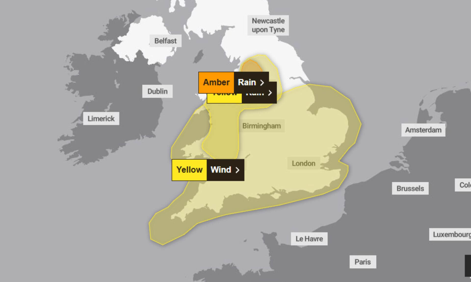
Yellow Weather Warning For Cornwall in Effect
The Met Office has issued a Yellow Weather Warning for Wind, in effect from 00:15 to 15:00 today, signalling potential disruption across Cornwall and other areas. Strong southwesterly winds, with gusts of up to 75 mph along the coast, could lead to travel delays, power outages, and risks to safety.
What to Expect
Residents and visitors in Cornwall are being urged to prepare for possible impacts, including:
- Travel disruption: Longer journey times or cancellations on roads, railways, and ferries.
- Damage to property: A slight chance of tiles being blown off roofs or other structural damage.
- Power cuts: The potential for power outages, which could affect services such as mobile phone coverage.
- Coastal hazards: Large waves and beach debris could create dangerous conditions along seafronts and coastal roads.
- Flying debris: A small chance of injuries or danger to life due to loose objects carried by the wind.
- Road closures: Some roads and bridges may close temporarily.
Winds to Peak with Heavy Rain
The strongest winds are expected to hit coastal areas in the west and south, with gusts of 65-75 mph forecast. Inland, gusts could reach 60 mph, particularly during a squally cold front moving southward with a band of heavy rain. Winds are predicted to ease as the front passes from the north later in the day.
How to Stay Safe
The Met Office advises taking the following precautions:
- Secure outdoor items: Bins, garden furniture, trampolines, and sheds should be checked and secured.
- Plan travel carefully: Check road conditions, bus and train timetables, and adjust travel plans if needed.
- Prepare for power cuts: Gather torches, batteries, and mobile power packs to avoid being caught out.
- Stay safe on the coast: Avoid areas with large waves and take care near cliffs. Keep dogs on a lead and know your route.
In an emergency, call 999 and ask for the Coastguard.
Keep Updated
Weather conditions can change quickly, and the Met Office recommends staying updated with the latest forecasts. Visit the Met Office website for more information.
Why Yellow?
The Yellow Warning signifies a low likelihood of occurrence but with a medium impact, warranting extra vigilance for those in affected areas.
Stay prepared and stay safe, Cornwall!
South West England weather forecast
Headline:
A wet and windy start to 2025, then much colder.
Today:
A dry start for some, but soon turning very wet with heavy rain setting in. Very windy with gales, severe in places. Winds easing by the afternoon and turning colder. Maximum temperature 7 °C.
Tonight:
Showery rain in southern counties at first, but becoming dry for most overnight with clear spells developing. Wintry showers are possible in Cornwall later. Frost and ice forming in places. Minimum temperature -2 °C.
Thursday:
Some frost first thing, then a cold day with plenty of sunshine for most. The odd wintry shower is possible in Cornwall and west Devon. Quickly turning frosty after dark. Maximum temperature 6 °C.
Outlook for Friday to Sunday:
Mostly sunny/clear skies at first with isolated wintry showers. Cloudier later in the weekend with a chance of rain and snow. Staying cold with overnight frosts and patchy freezing fog.
Updated:
Share This Story, Choose Your Platform!
To keep up with the latest cornish news follow us below
Follow CornishStuff on Facebook - Like our Facebook page to get the latest news in your feed and join in the discussions in the comments. Click here to give us a like!
Follow us on Twitter - For the latest breaking news in Cornwall and the latest stories, click here to follow CornishStuff on X.
Follow us on Instagram - We also put the latest news in our Instagram Stories. Click here to follow CornishStuff on Instagram.
You Might Also Be Interested In


Latest News In Cornwall


Daily Cornish news by email
The latest daily news in Cornwall, sent direct to your inbox.


